At Virginia Tech’s Kentland Farm, researchers are testing autonomous aircraft that could one day make hyperlocal forecasts as routine as sunrise.
If you don’t like the weather, wait five minutes — or drive nine miles.
Because on a morning when the autumn sky above Virginia Tech’s Blacksburg campus gleamed a buoyant blue, fog had settled in at Kentland Farm, the university’s 1,800-acre agricultural research facility 20 minutes down the road.
The 300-foot runway where aerospace engineering professor Craig Woolsey’s team intended to launch a drone was completely socked in.
No clear skies, no launch.
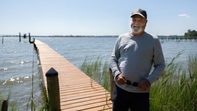
As bizarre as the weather seemed, river drainage fog is actually a standard feature of Kentland Farm, based on cool air moving over the warmer water of the New River. “It just has its own weather,” Woolsey said. “My students know to check the fog before they even drive out here.”
In the future, the very drones being tested at the Kentland Experimental Aerial Systems (KEAS) Lab could help create more accurate forecasts for microclimates like this one, both here and across the country.


The drone age
Thanks to recent advancements in fields like power electronics, cloud computing, artificial intelligence, machine learning, control and estimation theory, and small-scale sensors, the drones that were once seen as a novelty act — flying Roombas adept at aerial photographs and not much more — are now poised to offer industry-changing applications in precision agriculture, environmental monitoring, emergency response, infrastructure inspections, surveying, and beyond.
Currently, the global drone market is valued at over $40 billion, with a few unicorn businesses valued at over $1 billion. Some of them, like Skydio, have even partnered with Virginia Tech. “There are tons of niche applications that are extremely valuable,” Woolsey said.
Toward a more accurate forecast
One industry that’s ripe for a drone-driven change is weather forecasting.
Currently, much of the National Weather Service’s data comes from a Victorian-era invention: weather balloons. At 100 weather stations around the country, employees fill the large balloons with hydrogen or helium and send them aloft twice a day.
In the air, an attached instrumentation package called a radiosonde measures and transmits atmospheric data like temperature, pressure, and humidity, while a GPS device in the radiosonde allows stations to calculate wind speed and direction. Around 60,000 feet, the balloon pops and plummets back to earth. The radiosonde is either collected by NOAA employees or mailed back to an address on the device by kind strangers.
It works, mostly, but it’s a little archaic. And it can’t possibly account for oddities like Kentland Farm’s microclimate, where Woolsey’s aerospace engineering graduate students have learned that sunny weather back on campus will likely burn off unwelcome fog by noon.
Woolsey imagines what would happen if the National Weather Service used drones to collect weather data, instead of or in addition to weather balloons. Across the country, autonomous drones would launch themselves, fly to 3,000 feet, take measurements, then land in a storage container and recharge with solar power. Instead of just 100 to cover the whole of the United States, there could be thousands of inexpensive and low-maintenance drones. Instead of entering the air twice a day, they could collect atmospheric data once an hour.
The result would be far more accurate weather forecasts at the micro-scale, a technological advancement that could impact industries like agriculture, energy, transportation, logistics, construction, urban planning, tourism, and more.
How important is it to pinpoint that it's going to rain on this field and not that one? “Well, if you're the farmer who's trying to decide whether or not to spread some expensive fungicide that's just going to be washed away, yeah, that could turn out to be really valuable information,” Woolsey said.
Since drones could take direct measurements at the low altitudes at which they’re required to fly anyway, “it's sort of a perfect match of what we're allowed to do and this critical need for atmospheric scientists to know what's happening in the Earth's boundary layer.”

Safety first
The biggest reason why the “weather drone in a box” concept hasn’t yet been widely implemented is aircraft safety. The Federal Aviation Administration (FAA) is still figuring out how to put drones into airspace safely alongside human-operated aircraft and helicopters. To keep them from crossing paths, the FAA generally segregates them, keeping drones flying below 500 feet. But the weather matters up to 3,000 feet.
For one project at the KEAS Lab, researchers outfitted unmanned aerial vehicles (UAVs) with GoPro cameras and intentionally flew them at each other, trying to create an algorithm that would detect a drone mid-air. “One of the big takeaways is it's really hard to see these things until you're right up against them,” Woolsey said. “Maybe 100 meters out is where you can see a drone. That's just not a lot of time to make a decision about what to do next.”


And that’s assuming that a drone-plane encounter is accidental. Drones were originally developed for military applications, and unmanned aerial vehicles have become a key feature in recent conflicts. According to the New York Times, drones now account for 70 to 80 percent of all casualties in the Ukraine conflict.
In fact, Virginia Tech recently received a multimillion-dollar grant from the U.S. Army Corps of Engineers for research on preparing for potential weaponized drone attacks on soldiers, civilians, and critical infrastructure. Woolsey is a collaborator on the project led by principal investigator Eric Jacques, Thomas M. Murray Family Associate Professor of civil and environmental engineering at Virginia Tech.
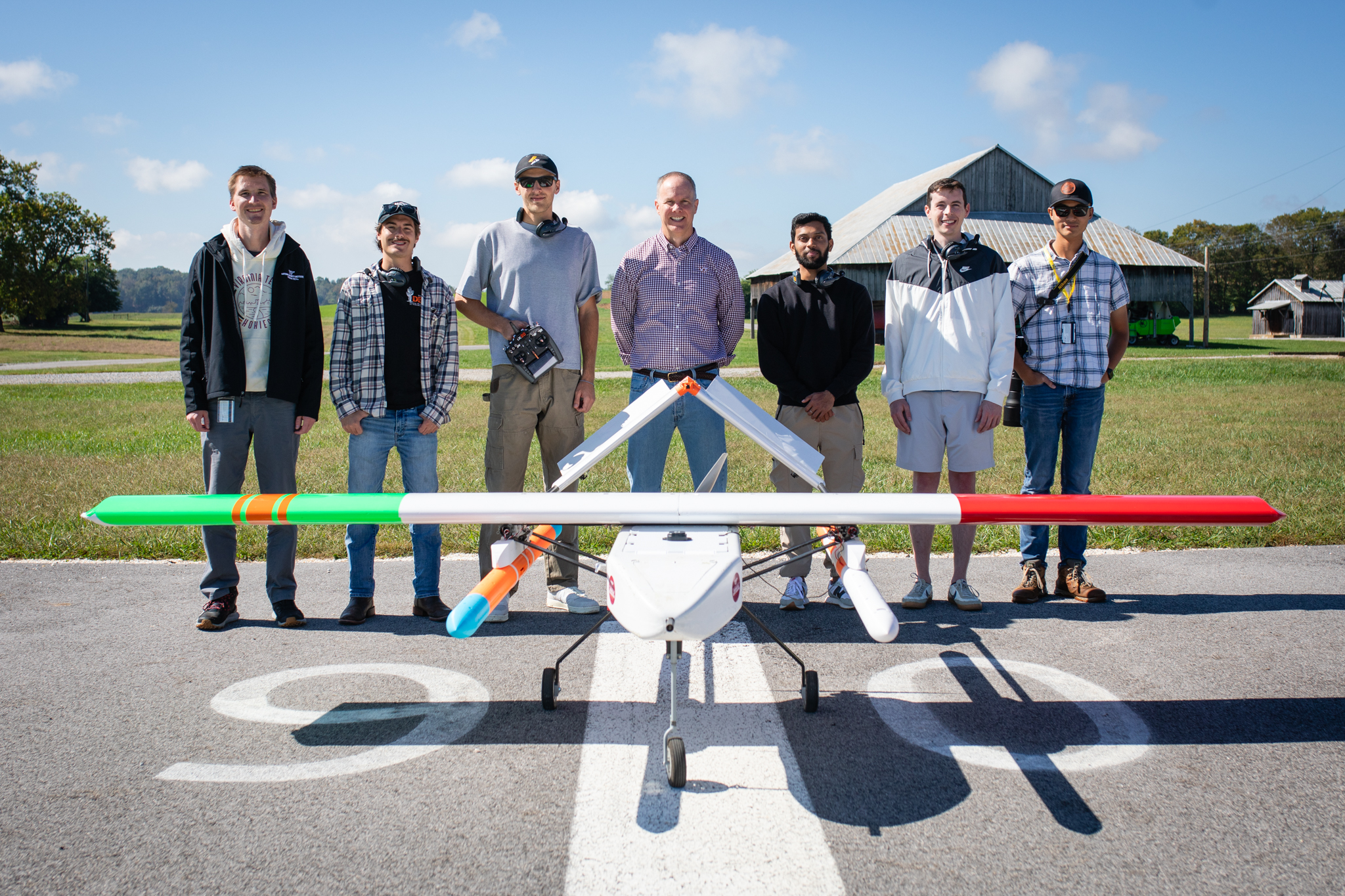
The pastoral test flight
Prepping the UAV in the KEAS Lab for today’s test of sensors, second-year aerospace engineering master’s student Mitchell Farah said, “I knew there was going to be fog, but it’ll burn off. That’s just a matter of time.”
He was right. By 11 a.m., the fog began to dissipate, clearing the way for a test flight.
One of the Woolsey team’s primary goals when they test UAVs is model identification, or figuring out how an aircraft behaves when you move its controls: the throttle, elevator, ailerons, and rudder that determine a plane’s up-down-left-right movement. In other words, they fly an unmanned plane in crazy maneuvers on purpose to create an aerodynamic model of what happens, as well as algorithms for controlling the aircraft.
Does that mean the researchers get to mix work and play? Well, yeah.
But today's mission was more straightforward. Two researchers from the Virginia Tech National Security Institute were testing alternative navigation methods that can be used in places where GPS can’t. Students carried a custom-designed UAV, with a fiberglass-composite fuselage and inverted V-tail and plastic-wrapped balsa-wood wings, to the runway, where the NSI researchers made sure the payload was securely attached.
When all was ready, Abishek Jeyaprakas, a second-year master’s student who was running the ground station, began the pre-flight checklist. Batteries? Check. Hatches? Check. Landing gear? Check. Props? Check.
With Mark Pinkleton, a first-year master’s student, positioned near the road to watch for cars and planes, the UAV chugged down the runway, then soared into the air. Farah operated the plane by remote, then switched it into autopilot mode.
For 30 minutes, this piece of highly futuristic equipment flew back and forth over the pastoral Southwest Virginia landscape of grain silos and rolling hills peppered with black-and-white cows before safely landing on the airstrip, a process that would be repeated several more times as variables changed.
There wasn’t a shred of fog left in the sky. And one day, a drone will help predict that.
If you want to have an impact on our students and faculty like those featured in this magazine, go here to support the College of Engineering. For more information, call (800) 533-1144.
-
Article Item
-
Article Item
-
Article Item